 Greener Leith Open Data Map
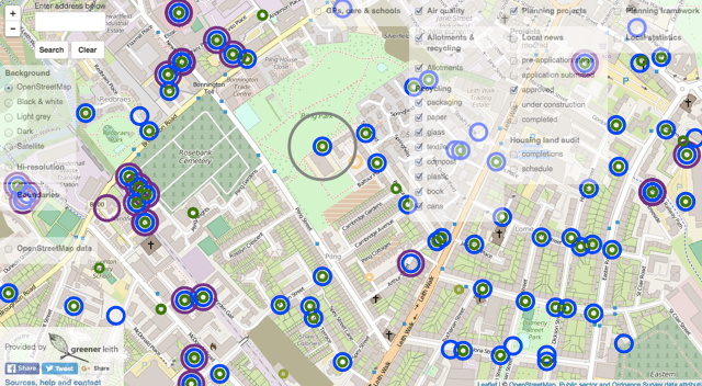
One of Greener Leith’s Board members, Jeremy Darot, recently created a very clever interactive online map which brings together essential data about Leith in one place. With the help of this map you can easily find all kinds of information; on local infrastructure such as doctors’ surgeries, schools, allotments, recycling facilities etc, but also on planning, air pollution and where housing is planned. Furthermore, it incorporates area statistics such as population density, Scottish Index of Multiple Deprivation and Vacant and the Derelict Land Survey. It shows the boundaries of electoral and community council wards and much more. For the time being you can find it here: http://edinburghopendata.info/story/edinburgh-open-data-map/. Please try it out.
We will be launching this map on the Greener Leith website in the next few weeks and use it to facilitate our 1000 Trees for Leith Project as it will be possible for anyone to register online and suggest suitable locations.